Aerial Photos and Map Overlays
|
|
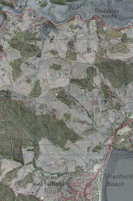
MapToaster Topo/NZ can now overlay a transparent
topographic maps on top of the aerial photography in NZAirPhoto.
This new feature combines the rich detail of aerial
photography with the information content of the topographic maps,
to give an unprecedented view of the terrain. You can clearly see
roads, walking tracks, placenames, contours
|
and other map features. The contours and shading
of the topographic maps overlaid onto the aerial photos make it
obvious where valleys and peaks lie, as well as giving the landforms
a three-dimensional feel that makes it easier to interpret.
A slider control provides instant adjustment of
the map transparency allowing you to gain the optimum view.
|
|
MapToaster NZAirPhoto image
|
|
|
|
Same area with 1:50,000 topographical
overlay
|
|
|
|